
Metals And Mining Review


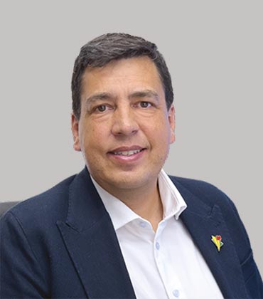 Glenn Chubak, President
By collecting measurements from multiple positions, directions and offsets, we build a denser, three-dimensional view of the subsurface, reducing geological uncertainty long before a drill touches the ground. Dias’ technologies enhance exploration for a broad range of critical minerals, including copper, uranium, gold, lithium and nickel, around the world, with over 1,000 surveys completed on six continents.
DIAS32, Dias’ patented flagship 3D Induced Polarization system, airborne electromagnetic and magnetic systems and high-power EM systems grew from that pursuit. The purpose is not simply to gather more readings, but to image critical information that conventional systems cannot resolve. The approach reflects the conviction of Dias’ scientists that returning to Earth is often three-dimensional, so 2D surveys cannot provide the full physics needed to understand it.
“We think about things from a pure physics point of view. That is always our starting point. We’re a bunch of physicists at heart and we build these technologies,” says Glenn Chubak, president.
Dias’ field crews work closely with the team of geoscientists and engineers behind its instrumentation, processing and modeling. Together, they form an integrated system from acquisition through data analytics to the final subsurface models. Mining companies call Dias when targets are deep, the terrain is difficult, or the geology remains unresolved by conventional methods. Dias’ data improves confidence in drilling decisions. This philosophy proved itself at Canadian Royalties, where Dias has supported exploration for over a decade. SQUID-based geophysics identified a conductive body at a depth that conventional methods likely would have missed. Following these results with an integrated BHTEM program contributed to a discovery earning Canadian Royalties the Prospectors and Developers Association of Canada’s Bill Dennis Award.
Replacing Survey Gaps with 3D Evidence
DIAS32’s distributed array architecture uses independent recording channels and deploys receivers across multi-square-kilometer areas. Current is injected from multiple points and receivers measure voltage responses across dozens of azimuths and offsets. One survey produces millions of readings, which numerical modeling converts into conductivity and chargeability volumes.
The density helps geophysicists resolve structure, close line-based survey gaps and refine ambiguous prospects into drill-ready targets. Dias’ volume, coverage and resolution remain unmatched within one DCIP survey. Its magnetotellurics work extends ground capability beyond DCIP.
Dias built its signal-processing stack in-house to complement its proprietary instrumentation. When noise conditions or unconventional operating environments arise, data scientists can tailor processing parameters to improve signal-to-noise performance and isolate the portions of the signal most relevant to the exploration objective. An extended SimPEG-based inversion workflow runs on purpose-built computer clusters, converting field measurements into 3D subsurface models and visualizations that sharpen drill-target definition.
Its ground instruments reflect field realities and are optimized for efficient field use. Several systems are less than 20 percent of the size and weight of competing equipment, improving safety and mobility in difficult environments. Their equipment can be transported virtually anywhere in the world and adapted to any project requirement or challenge.
-
We think about things from a pure physics point of view. That is always our starting point. We’re a bunch of physicists at heart and we build these technologies.
Dias built its signal-processing stack in-house to complement its proprietary instrumentation. When noise conditions or unconventional operating environments arise, data scientists can tailor processing parameters to improve signal-to-noise performance and isolate the portions of the signal most relevant to the exploration objective. An extended SimPEG-based inversion workflow runs on purpose-built computer clusters, converting field measurements into 3D subsurface models and visualizations that sharpen drill-target definition.
A Different Vantage Point
Some exploration challenges are better surveyed from the air. Dias deploys several airborne and semi-airborne technologies: QMAGT is full-tensor magnetic gradiometry and the most advanced airborne magnetic system currently available. This system uses SQUID-based quantum sensors developed in collaboration with Supracon AG to achieve higher resolution and richer data. The QAMT system provides large-coverage datasets from a helicopter. In challenging terrain or dense vegetation, an airborne system heavily reduces the operational difficulty of field crews. Where crews cannot enter, Dias’ HeliWinder system lays out transmitter wire in large loops from a helicopter— a unique, patented technology that provides safety and operational benefits. The Sub Audio Magnetics (SAM) technology is a proprietary technique based on fast-sampling total-field magnetometer sensors for low-noise resistivity and EM surveying. SAM surveys may be deployed by helicopter, drone, UTV, or on foot.
Engineering the Next Solutions
Roughly 10 percent of Dias’ workforce is dedicated to R&D - its largest investment - driving its technology roadmap. New systems advance only when they can significantly outperform existing alternatives.
Dias 4D emerged from this model. By repeating 3D surveys over time, operators can monitor saturation and subsurface changes in heap-leach pads and tailings facilities. Techniques originally developed to find ore can help identify inefficiencies or emerging risks early enough to plan mitigation in engineering applications. Dias’ technology portfolio continues to expand under this development model.
For Dias, exploration decisions begin with knowing more before drilling. That physics-first approach earned recognition from Metals and Mining Review, which named Dias the Top Ground & Airborne Geophysical Survey Solutions In Canada 2026.
“The adage, ‘Measure twice and cut once,’ is reimagined by Dias’ technologies. In mineral exploration, we help clients measure a million times before drilling once, ensuring every exploration dollar is committed with greater confidence,” says Chubak.
Ground and Airborne Geophysics for More Defensible Drill Targets
Mineral exploration programs can spend heavily before the first drill confirms whether a target is worth pursuing. Survey coverage and data density shape how confidently teams can narrow those targets, while terrain can determine whether planned measurements are practical at all. Sparse measurements may leave too much room for interpretation. Difficult ground can constrain instrument placement. The buying question is less about collecting another geophysical layer than about whether the survey produces enough defensible information to move drilling decisions forward with less uncertainty.
Data density deserves close scrutiny because complex ore bodies rarely conform to simplified survey geometry. A system that samples only limited directions or offsets can leave blind spots in the resulting model. Buyers should examine whether a survey can capture genuinely three-dimensional responses across a broad area and whether the acquisition design supports enough measurements to distinguish geological structure from noise. Scale matters here. Large data volumes become useful only when the instrumentation can collect them without creating an unmanageable field burden.
“DIAS’s processing stack can be adapted to unusual noise conditions and carried through inversion into three-dimensional visualization.”
Processing quality can matter just as much as acquisition. Noise conditions vary by site and standard processing stacks may not handle unusual interference well. A provider should be able to adapt signal processing to the environment rather than force every survey through the same workflow. Buyers also need to understand how raw measurements move into inversion models and visualization. The useful endpoint is not a dense dataset by itself. It is a subsurface model that geologists can interpret alongside other available evidence and use to refine drilling targets.
Field deployment introduces a different test. Exploration areas may involve steep ground or limited road access, and some locations make conventional survey layouts impractical. Equipment weight and deployment method can affect crew safety and the amount of terrain that can realistically be covered. Airborne methods can reduce contact with difficult ground. Specialized deployment systems can extend surveys into areas that would otherwise be excluded. Survey design should therefore be judged on how well it preserves data quality when terrain limits access.
Model usefulness also depends on how well geophysical results can be combined with geological knowledge. Large datasets do not remove interpretation risk on their own. The stronger survey programs make it easier to connect the physical response measured in the field with the broader subsurface picture already available to the exploration team. Computing architecture matters as datasets grow, particularly when inversion workloads require hardware suited to unusually intensive processing rather than generic capacity.
DIAS fits these requirements through technology developed around large-scale subsurface imaging and difficult field conditions. Its DIAS32 system uses a fully distributed array to collect true three-dimensional electrical data at very high data volumes, supported by in-house signal processing and specialized compute infrastructure. It also operates magnetotelluric and airborne systems, including HeliWinder deployment for terrain that is hard to reach on foot. Its processing stack can be adapted to unusual noise conditions and carried through inversion into three-dimensional visualization. For buyers who need deeper survey coverage and more confidence in target definition, DIAS offers a technically grounded fit.
...Read more
Ground and Airborne Geophysical Survey Solutions in Canada Info
Q1
What Are Ground & Airborne Geophysical Survey Solutions in Canada?
Ground & Airborne Geophysical Survey Solutions in Canada use measurements collected from the surface or aircraft to investigate geological structures and subsurface conditions. Ground surveys offer detailed information over selected areas, while airborne methods can cover large or remote terrain efficiently. Used together, Ground & Airborne Geophysical Survey Solutions in Canada can help exploration teams identify anomalies, understand geological formations and decide which areas warrant closer investigation.
Q2
How Does DIAS Support Geophysical Survey Work?
DIAS provides Ground & Airborne Geophysical Survey Solutions in Canada for collecting and interpreting geophysical information used in mineral exploration. Its work links field acquisition with data processing and interpretation, turning survey measurements into information that can support exploration decisions. That connection matters when large areas need to be assessed without losing the detail needed to examine potentially significant subsurface responses.
Q3
What Is the Role of Airborne Geophysical Surveys?
Airborne surveys are an important part of Ground & Airborne Geophysical Survey Solutions in Canada because they can cover extensive or difficult-to-access terrain efficiently. Magnetic, electromagnetic and gravity surveys can identify variations associated with geological structures and mineral systems. Exploration teams can then combine these datasets with geological and other exploration information to determine where additional ground investigation or drilling may be warranted.
Q4
Why Are Ground Surveys Important for Mineral Exploration?
Ground surveys allow exploration teams to examine selected areas in greater detail. Within Ground & Airborne Geophysical Survey Solutions in Canada, ground-based methods can provide higher-resolution information across targets identified through regional exploration and help clarify airborne anomalies. Depending on the objective, electromagnetic, magnetic, gravity, induced polarization or resistivity surveys can offer different views of subsurface conditions.
Q5
How Can DIAS Connect Survey Data With Exploration Decisions?
DIAS treats Ground & Airborne Geophysical Survey Solutions in Canada as part of a wider exploration workflow rather than as a standalone acquisition exercise. Its work includes geophysical data collection and interpretation, with measurements assessed in relation to geological objectives. This can help exploration teams move from raw survey results toward clearer target definition and better-informed decisions about subsequent field programs.
Q6
What Should Companies Consider When Selecting Geophysical Survey Solutions?
Companies evaluating Ground & Airborne Geophysical Survey Solutions in Canada should consider the geological setting, survey objective, required resolution, terrain, coverage area and the type of anomaly being investigated. Data quality and interpretation also deserve close attention. Sound measurements still need appropriate processing and geological context. The right approach matches the survey method to the exploration question, then integrates the results with other available evidence before major drilling or field expenditure is committed.
Company
Dias
Management
Glenn Chubak, President
Description
Dias is a geophysical technology and survey provider delivering advanced subsurface imaging for mineral exploration. Its proprietary ground, airborne and monitoring systems capture deeper, higher-resolution data, helping mining companies refine targets, navigate difficult terrain and make better-informed drilling decisions worldwide.
