
Metals And Mining Review


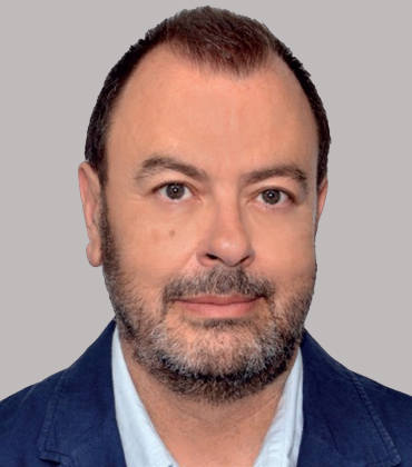 Antonio Lozano, Director
In mining, uncertainty is expensive and sometimes dangerous. A slight shift in a slope, an unnoticed rise in pore pressure, or a delayed data report can escalate into operational shutdowns, financial losses, or worse, safety incidents.
This risk is often compounded by the way monitoring systems have traditionally been managed. Companies would procure instruments from one provider, rely on another for installation and commissioning, and then turn to yet another service partner when issues arose. This fragmented approach created gaps in accountability and consistency, ultimately leading to unreliable data and poor traceability.
Geoengineering Services & Consulting EIRL addresses this at a systems level. Headquartered in Lima and active across Peru, Bolivia, Ecuador, and Chile, the company delivers integrated geotechnical instrumentation and automated monitoring programs that unify sensor networks, data acquisition, and platform-based analysis. By managing the full monitoring lifecycle, the company enables mining operators to maintain continuous, reliable visibility into ground behavior and align data directly with operational decision-making.
“Each instrument we install is designed to answer a specific geotechnical question. Reliable monitoring begins with clearly understanding what needs to be measured, why it matters, and how that data will be used to assess performance and manage risk,” says Antonio Lozano, director.
How does integrated monitoring design improve reliability and traceability of geotechnical data?
Founded in 2012, the company approaches monitoring as a complete engineering system that begins with understanding the technical characteristics of each project. Environmental conditions, topography, hydrogeological properties, and the geotechnical characteristics of the structure being monitored all influence the design of the instrumentation program. These factors guide the selection of sensors and the architecture of the data transmission system used to collect and manage monitoring information.
-
Each instrument we install is designed to answer a specific geotechnical question. Reliable monitoring begins with clearly understanding what needs to be measured, why it matters, and how that data will be used to assess performance and manage risk.
Why is continuous real-time data important for managing geotechnical risk effectively?
Through automated monitoring systems, Geoengineering Services & Consulting EIRL enables continuous measurement of parameters like deformation, pore water pressure, structural stress, settlement, tilt, and temperature. The ability to correlate this information with construction stages or operational activities enables engineers to verify that slopes, structures, and other components behave as designed. When measurements approach defined thresholds, automated alerts notify project teams so that mitigation measures can be implemented in accordance with established contingency plans.
One example of this approach is the Tantahuatay open-pit gold and silver mining operation in Peru, operated by Compañía Minera Coimolache and part of Grupo Buenaventura. At this site, Geoengineering Services & Consulting EIRL implemented an automated monitoring system that integrates piezometers, inclinometers, settlement cells, prisms, and accelerographs within a cloud-based instrumentation management platform. The system provides continuous observation of geotechnical behavior across key site components.
In what way do modern technologies enhance monitoring capabilities in complex mining environments?
Within one of the mine’s waste dump areas, automated tilt monitoring has been used to observe slope behavior during the unloading of mining trucks. The integration of sensors with real-time alerts supports safer operating conditions while allowing production activities to continue without interruption.
For Geoengineering Services & Consulting EIRL, effective monitoring extends well beyond the installation of instrumentation. Monitoring programs begin with defining the geotechnical questions that must be answered throughout the life of a project. Each instrument is selected and positioned to generate data that supports engineering analysis, operational awareness, and risk control.
Advances in technologies such as IoT connectivity, wireless communication networks, and intelligent data platforms continue to expand the capabilities of modern geotechnical monitoring. By integrating these technologies into instrumentation programs, Geoengineering Services & Consulting EIRL helps mining operators maintain continuous awareness of site conditions and strengthen their ability to anticipate and manage risk in complex operating environments.
Mining Instrumentation and Monitoring Services in Latin America Info
What distinguishes Geoengineering Services & Consulting EIRL in the mining monitoring sector?
Geoengineering Services & Consulting EIRL has developed a specialized position within Mining Instrumentation and Monitoring Services in Latin America through its focus on geotechnical instrumentation, automated monitoring systems and infrastructure-focused engineering support. Based in Lima, the company designs integrated monitoring solutions for mining and civil infrastructure environments where measurement accuracy and continuous data visibility are critical. Its approach combines instrumentation deployment with real-time monitoring capabilities, allowing customers to improve site awareness, risk evaluation and decision-making across complex operating conditions.
Why has the company gained recognition in mining instrumentation and monitoring?
Growing demand for reliable geotechnical data has increased the importance of advanced monitoring capabilities across mining operations. Geoengineering Services & Consulting EIRL has earned recognition among providers of Mining Instrumentation and Monitoring Services in Latin America by focusing on integrated sensor systems that support long-term infrastructure stability and environmental oversight. The company emphasizes customized monitoring architectures rather than one-size-fits-all deployments, helping projects address site-specific geological and operational challenges more effectively. Its ability to connect instrumentation data with actionable analysis strengthens confidence in monitoring performance across demanding mining environments.
How does Geoengineering Services & Consulting EIRL support mining project safety and stability?
Accurate monitoring plays a central role in reducing uncertainty around ground conditions, structural performance and environmental behavior. Geoengineering Services & Consulting EIRL supports Mining Instrumentation and Monitoring Services in Latin America by implementing systems that provide continuous measurement and reporting across critical project areas. The company integrates automated monitoring tools with geotechnical instrumentation to help customers track movement, deformation and changing site conditions in real time. This monitoring framework improves visibility into infrastructure performance while supporting faster response to emerging risks.
What role does technology play in the company’s monitoring solutions?
Technology-driven monitoring systems form the foundation of the company’s service model. Geoengineering Services & Consulting EIRL applies automated instrumentation, remote data acquisition and integrated sensor technologies to strengthen monitoring accuracy and reporting continuity. Within the broader field of Mining Instrumentation and Monitoring Services in Latin America, the company focuses on systems that allow customers to access live project data and improve engineering oversight without relying solely on manual inspection cycles. Its use of automation and digital monitoring tools aligns with the mining industry’s increasing adoption of real-time environmental and geotechnical intelligence.
How does the company create long-term value for mining operations?
Reliable instrumentation systems help mining operations maintain stronger oversight of infrastructure performance throughout project development and production phases. Geoengineering Services & Consulting EIRL creates value by designing monitoring frameworks that improve data consistency, project visibility and engineering confidence. Its work in Mining Instrumentation and Monitoring Services in Latin America supports customers managing tailings facilities, slopes, civil structures and other high-priority infrastructure requiring continuous observation. The company’s emphasis on integrated system design and long-term monitoring support contributes to more informed operational planning and infrastructure management.
Why is Geoengineering Services & Consulting EIRL relevant to the future of mining infrastructure monitoring?
Mining operators continue increasing investment in digital monitoring, environmental accountability and infrastructure resilience, particularly across large-scale projects in Latin America. Geoengineering Services & Consulting EIRL addresses these evolving requirements through automated monitoring systems, advanced instrumentation deployment and engineering-focused implementation strategies. Its specialization in Mining Instrumentation and Monitoring Services in Latin America positions the company to support projects seeking higher levels of data transparency, operational awareness and geotechnical reliability. As mining infrastructure becomes more technologically connected, the company’s expertise in integrated monitoring systems remains increasingly relevant.
Company
Geoengineering Services & Consulting
Management
Antonio Lozano, Director
Description
Geoengineering Services & Consulting EIRL is a Lima-based engineering company specializing in geotechnical instrumentation and automated monitoring systems for mining and civil infrastructure projects. The company designs integrated sensor networks and cloud-based platforms that provide real-time data on ground behavior, enabling operators to manage geotechnical risks, enhance safety, and support informed operational decision-making.

